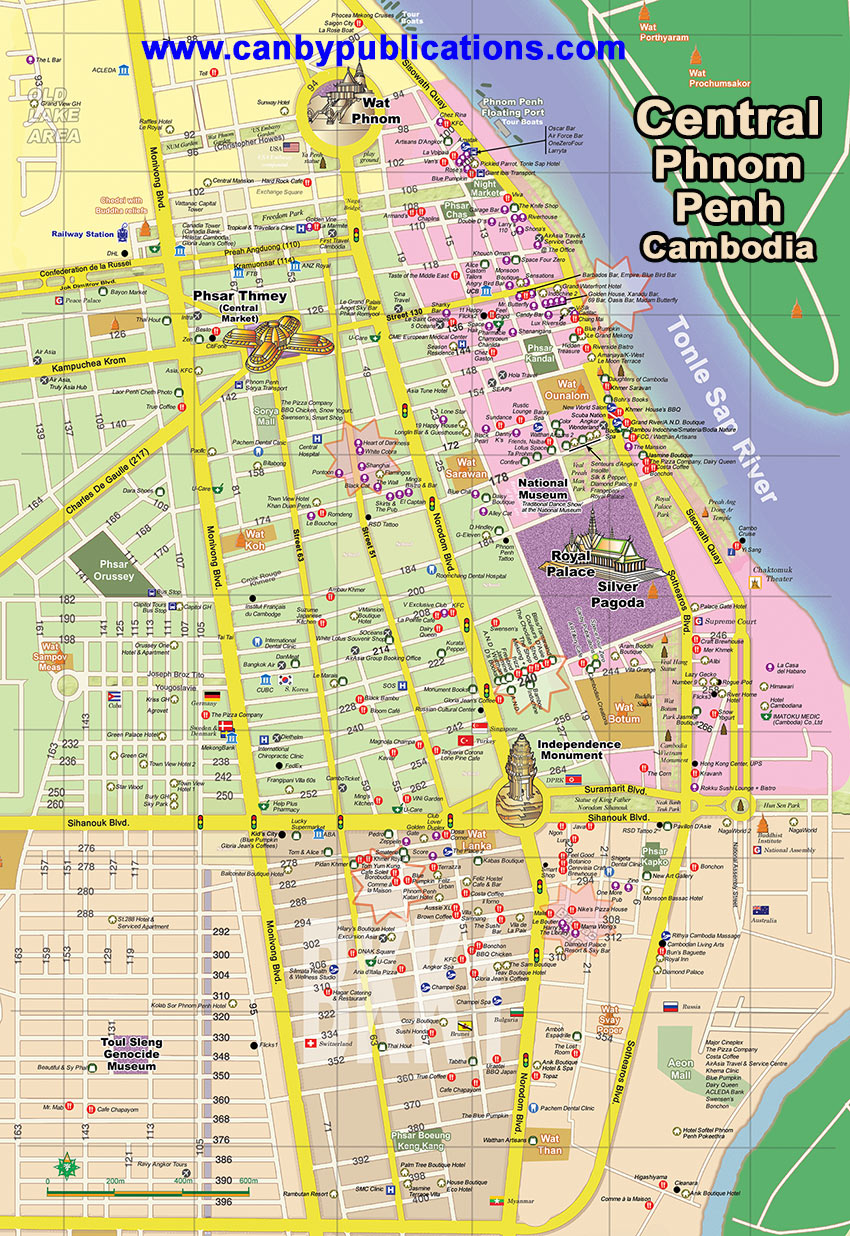
Map - Central Phnom Penh,
Cambodia (click to enlarge)
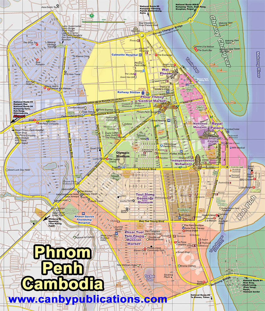
Map - Phnom Penh,
Cambodia (main body of city, click to enlarge)
Orientation
The main body of Phnom Penh sits along the west side of the Tonle Sap and Bassac Rivers. The airport is at the western edge of town, about 9km (40-60 minutes) from town center. Most in-city points of interest lie within 10-20 minutes of each other. Hotels, restaurants and shops are spread across the city, though there is a greater concentration toward the center of the town, especially near and along the riverfront. Public transportation including tuk-tuks, taxis, mototaxis and cyclosare readily available citywide making it easy to catch transport from one site to the next.
Though hotels, restaurants, bars, spas and shops are spread across the city, many are clustered into small districts, bar streets and tourist areas, each unique in its own way.
Always bustling, the riverfront is the most popular tourist district the city with dozens of restaurants, bars, shops and hotels lining the riverside and adjoined roads, including several bar streets such as Streets 136, 110 and 104. Another late-night bar street is Street 51 near Street 172, sporting a couple of blocks of pubs and clubs, all hopping well into the wee hours
.
The Boeung Keng Kang (BKK) area is dotted with a mix of restaurants, bars and hotels as well as a more relaxed atmosphere, drawing more travelers, NGOers and the like. The neighborhood east of Norodom, including Bassac Lane, also harbors an eclectic collection of boutique hotels, cafes and bar
.
For budget travelers, a couple of the more popular areas in town include Street 172 a block off the riverfront behind Wat Ounalom, and another on Street 258 a couple of blocks from the Palace. The Boeung Keng Kang area also has its share of budget accommodation. |