Map - Battambang City,
Cambodia
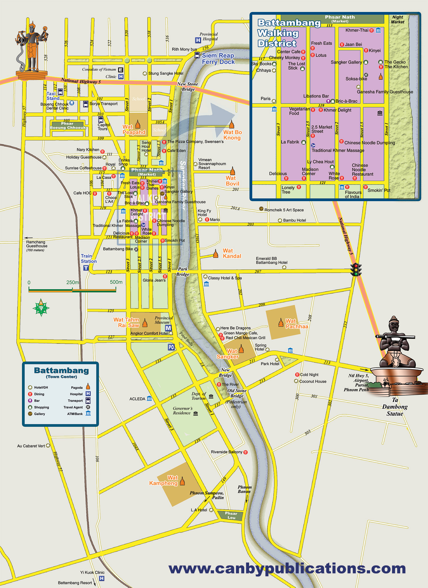
Battambang is a charmingly quaint provincial capital - classic architecture and old pagodas set picturesquely along a river, and even though the city is one of the country's largest it is still lightly touristed. In town, colonial-era buildings line narrow lanes, including the ‘walking district’ near the market where art galleries, cafes, shops and bars inhabit old shophouses. Battambang is a place to explore the architecture and art scene, check out the local cuisine, and to use as a base for excursions into the nearby countryside. Outside town the scenery quickly becomes one of villages and rice paddies, offering an excellent opportunity to see a bit of rural Cambodia. The nearby countryside harbors several picturesque old pagodas, Angkorian ruins, caves, mountains, waterfalls and the famous ‘bamboo train.'
Battambang sits along the Sangker River with the downtown area on west side. Parks line sections of the riverfront. The eastern approach to the city on Route #5 is marked by a statue of Ta Dambong holding bat dambang. Three main north/south roads form the spine of the business district. Several cafes, bars, shops dot the streetsof the ‘Walking District’ just south of the market (in purple). The town is only a couple of kilometers long and relatively easily traversed by foot.
|